Linking marine litter ground truth and remote sensing data
Working on remote sensing for ocean plastic detection? Carrying out campaigns for ocean plastic surveying?
Get involved and participate today with full credit and recognition.
What is Ocean Scan?
Ocean Scan is a global database offering access to a curated collection of in-situ observations and matching remote sensing images of marine litter and debris. Ocean Scan facilitates remote sensing research and supports the design of targeted experimental and litter collection campaigns with high-quality data, in a unified format.
Ocean Scan is designed to promote international cooperation and is endorsed by the IOCCG Task Force on Remote Sensing of Marine Litter and Debris.

How does it work?
The database is accessible via this web and via API. Upon registration, users can access existing campaigns, related observations and detailed information about material composition, location and time stamp, among others. Users can contribute with their own observations and campaigns by uploading them through the web portal, or ingesting them in real time through Ocean Scan’s mobile app.

Easy-to-use interface
for data upload, consultation and download

Flexible but consistent data format
designed for remote sensing technologies and AI modelling

Provenance and credit
with the association of a DOI link and the application of different disclosure agreements via metadata

Collection and combined exploitation
of satellite and in-situ data

Unified reference point
for marine litter observations, to promote global cooperation and align international and local efforts

Centralized information
of in-situ data for EO models validation and marine litter collection campaigns planning
Why should I contribute?
Ocean Scan ensures full credit recognition to its contributors.
With the automatic association of each campaign to a Zenodo DOI, Ocean Scan supports you in the dissemination of your research data. In addition, you can decide to openly share the complete dataset or just its generic metadata.
Pioneering experts that voluntarily supported Ocean Scan in its early stages, sharing their high-quality data with the whole reseach community.
Who can participate?
Any organization and individual working in the field of marine litter can contribute: from remote sensing researchers to international and local groups performing collection campaigns on the ground.
Ocean Scan is free of charge and is based on international voluntary participation. We welcome global contributors to support the initiative and accelerate global knowledge and action.
About Ocean Scan
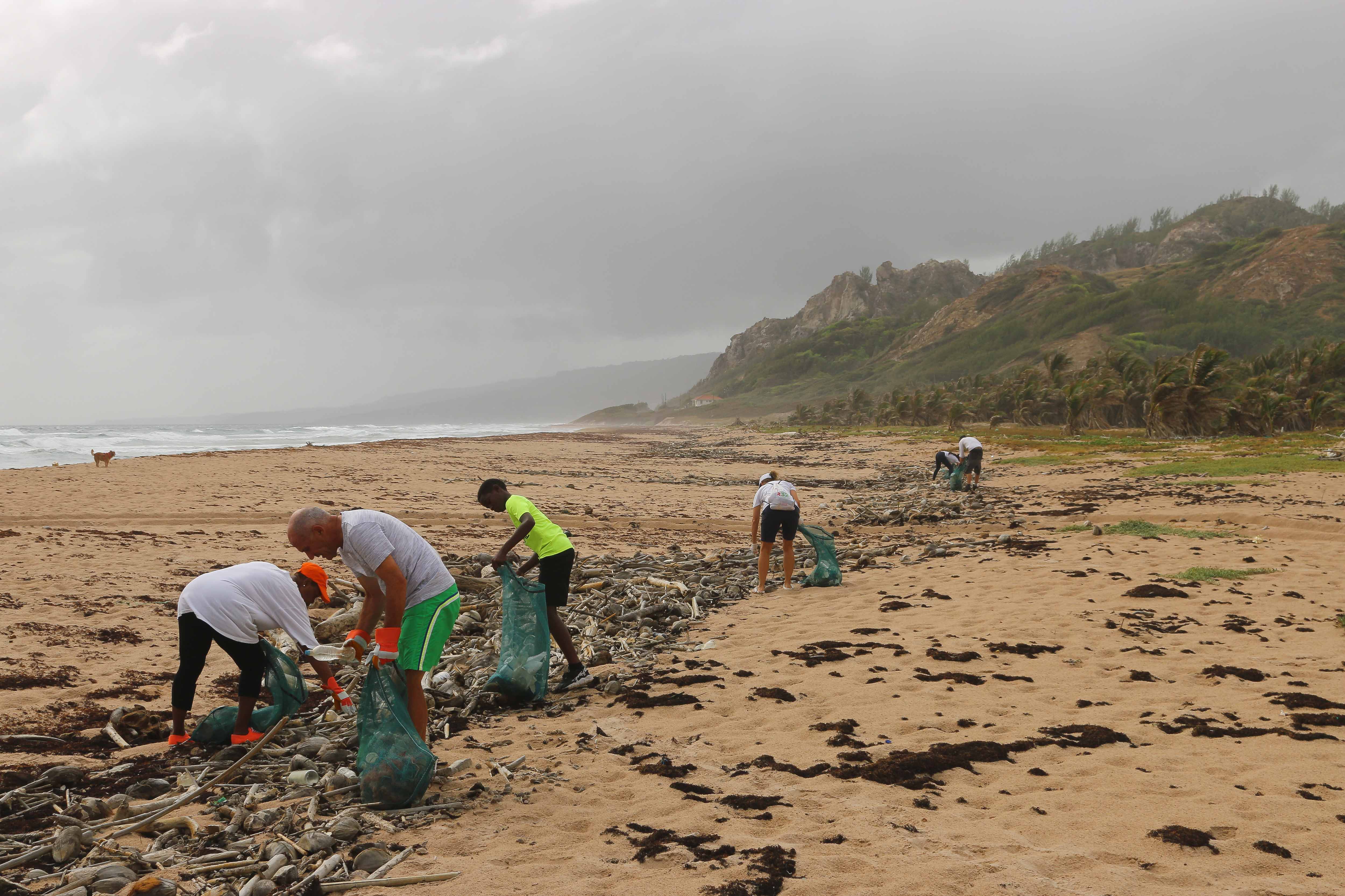
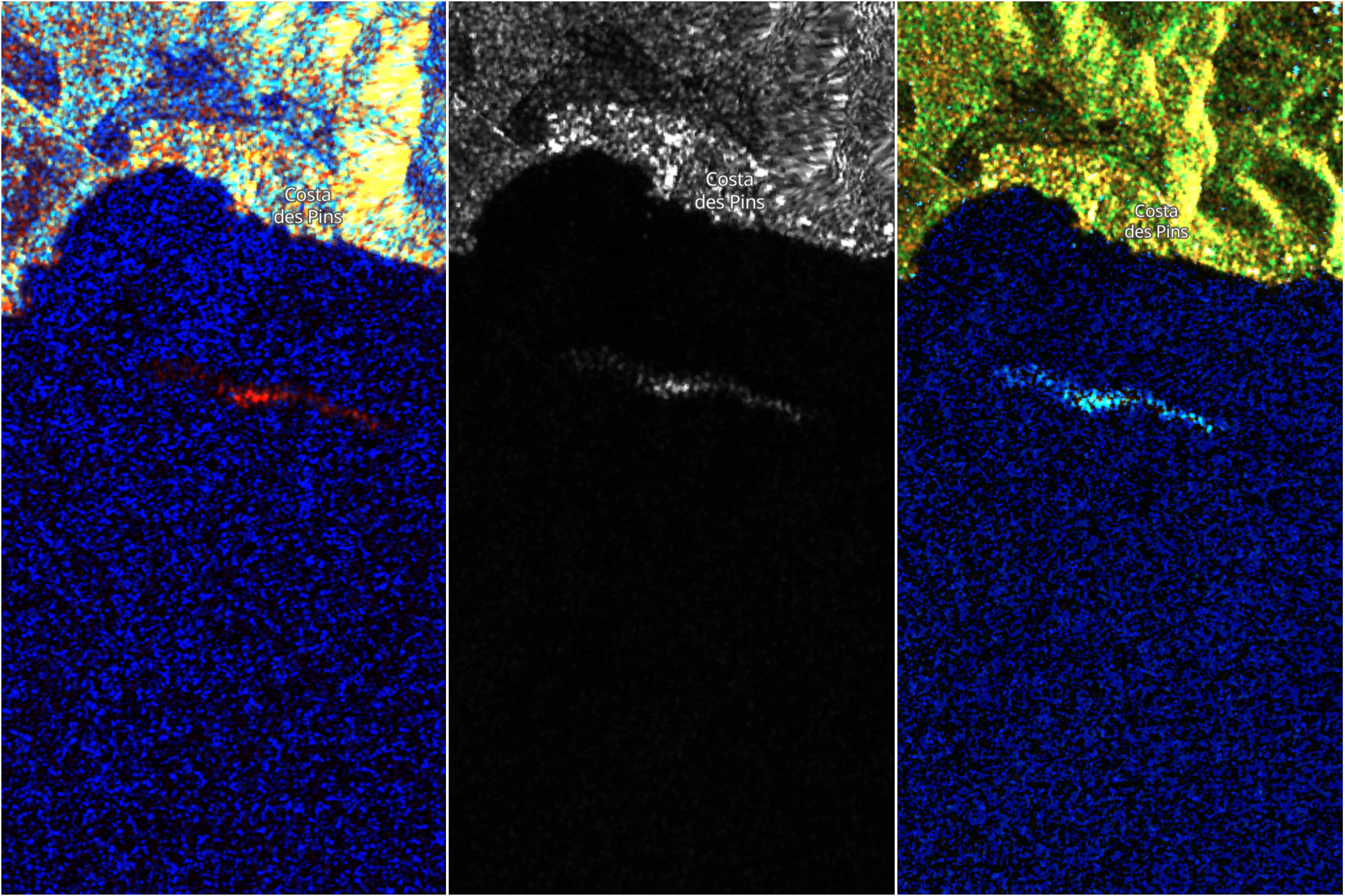
Despite the progress done to address the problem of marine litter, remote sensing research is experiencing a scarcity of relevant validation data. Ocean Scan is born to address this need and to support researchers with high-quality curated data. Remote sensing technology can help in the early detection of litter accumulations. On-time and accurate information supports targeted collection campaigns on the ground and enables to identify pollution pathways, to act at the source of the problem.